First Anniversary in the Mountains
WOW! This anniversary we celebrated in our new home in the mountains! Despite the post title, this is not our first anniversary. However, this is the first we’ve celebrated at the ranch, where we now live full time! Praise the Lord for His Grace!
To celebrate the occasion, we decided to take a little adventure trip around the area. We seem to never have time to go visit anything as we always are doing construction, going to acquire materials, going for groceries, or many of the other things that have to be done to make the ranch livable, and prepare for the winter season.
Gabriella, NM
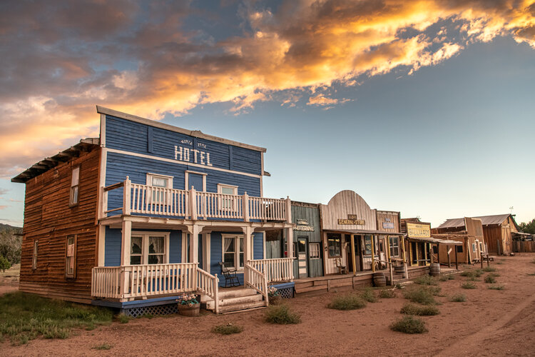
So, here we go… First stop, Gabriella! Gabriella is a version of an 1880’s style old west town, built by Henry Iams, on the north slope of the Horse Mountains, about 15 miles west of Datil, NM. We can see the town from our ranch, but have never had the time to drive there. Unfortunately, it is not really a tourist destination. It was created to be primarily a movie set for Western movies, although they do host private parties, weddings, and of course movie production.
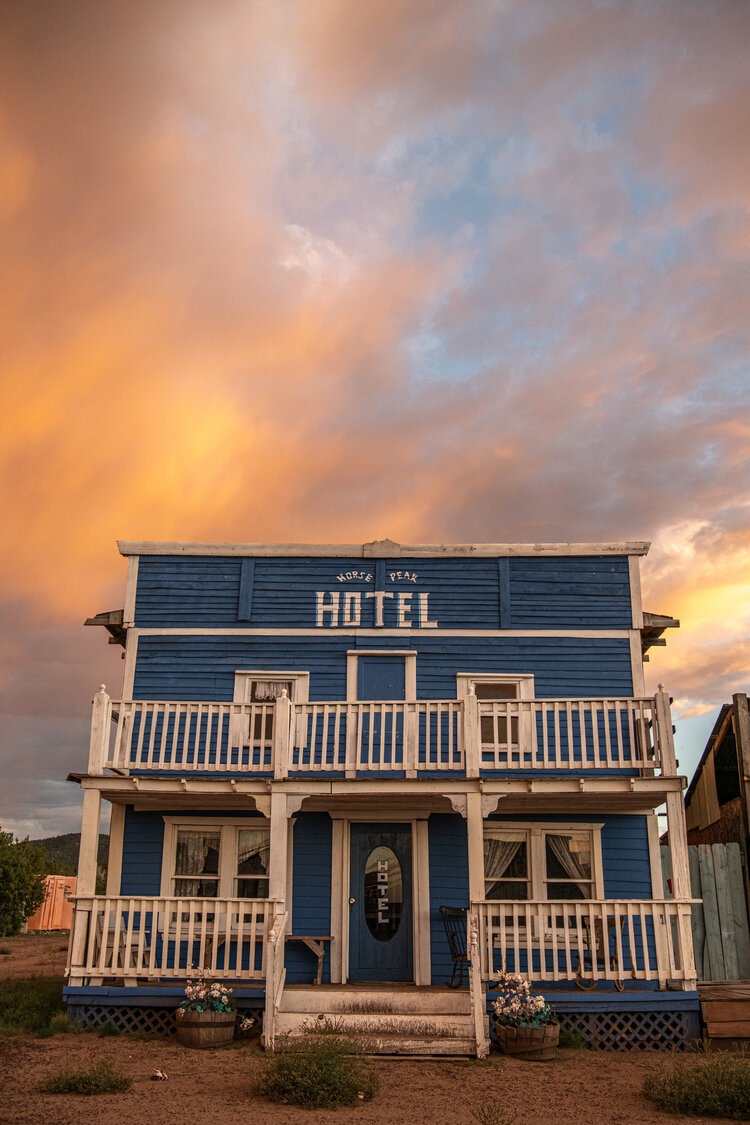
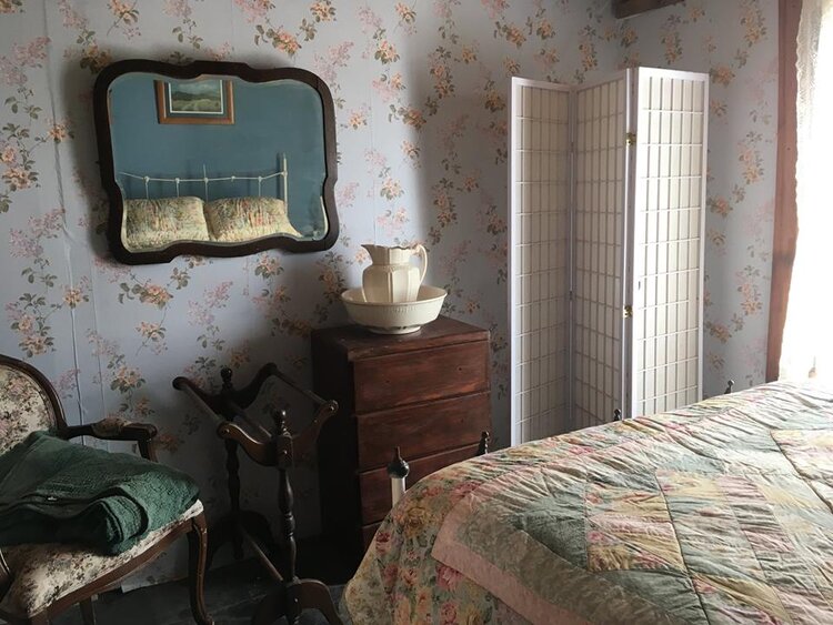
Also, for the authentic experience, guests can stay in a fully furnished hotel room. However, we faced a locked gate, so that was the end of that phase of our adventure.
Magdalena, NM
Our next destination was one we had passed dozens of times, but as mentioned above, never had the time to explore. The Magdalena Stock Shipping Pens located just north of the main street (Highway 60) in Magdalena, New Mexico, was the termination of many trail drives during the end of the 19th and the early part of the 20th century.
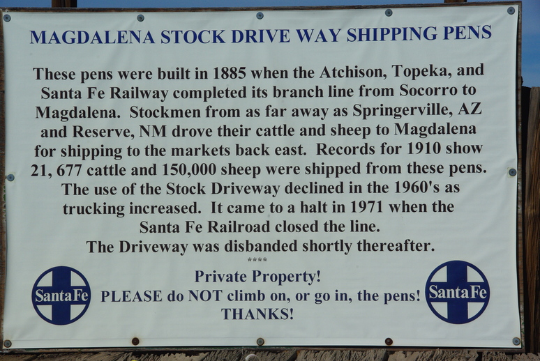
The stock pens, at the termination of the Magdalena Stock Driveway, shipped as many as 21,000 cattle and 150,000 sheep per year from 1885 to 1971. In the later years, trucking took over from the railroad for shipping the animals. The Stock Driveway, which varied from five to ten miles wide, hosted cattle and sheep drives from as far away as Springerville, Arizona.
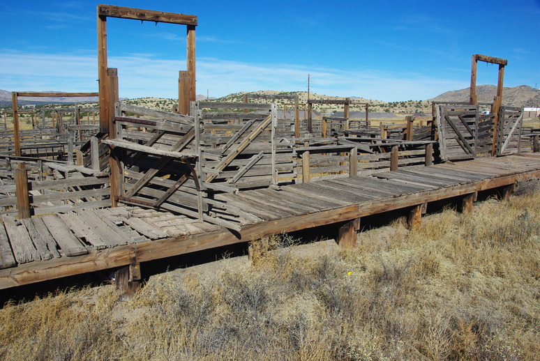
As can be seen in the photo, the pens are in a sad state of disrepair. It seems as if the railroad went right in front, where four cars at a time could be loaded, both upper and lower decks. The pens behind the loading dock are quite extensive, but grown up in weeds!
It seems a branch of the rail line from Socorro also went from Magdalena to the former town of Kelly, where zinc from the mines there was loaded and shipped. From the Abandoned Rails website:
This branch was constructed in the 1880s as a spur from Santa Fe’s Albuquerque-El Paso line. A junction was built at Socorro, and the branch headed generally west (and uphill) to Magdalena. Magdalena had zinc mines in the area; it was also used as a railhead for shipping livestock from the ranches in the area. One of the last big cattle drives in the west occurred in Magdalena, in 1972. The branch was also abandoned that year, due to declining mineral traffic from the mines. (Livestock shipments had moved to trucks sometime earlier.) As recently as 1999, a segment of the branch remained in service within the city limits of Socorro, including a grade crossing over US Route 60. West of Socorro, some parts of the abandoned right of way can be seen parallel to US Route 60 to the north.
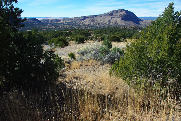
Kelly, NM
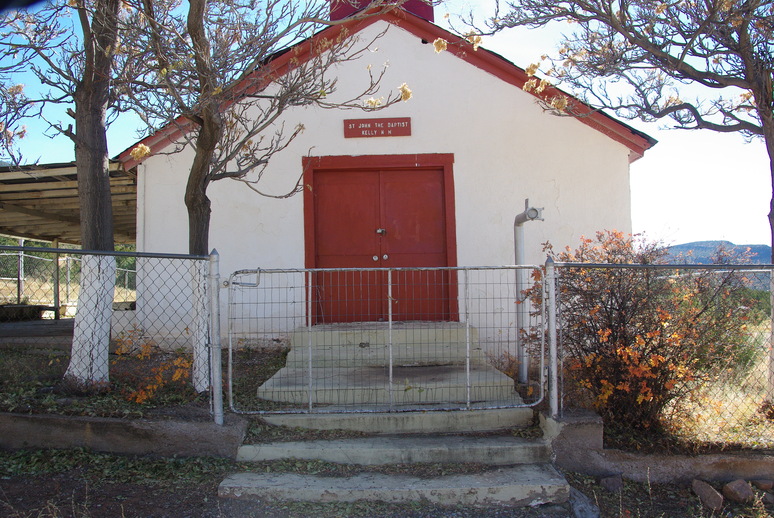
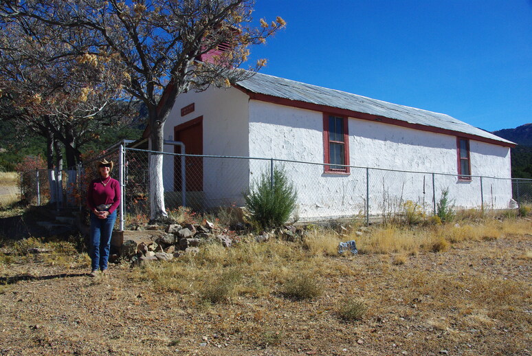
Our next stop used to be a booming mining town, back when the mines located there extracted zinc in great quantities, mostly for use in paint products. When we arrived, there wasn’t much to see, as by 1947, most of the houses were relocated to Magdalena when the mines gave out, and most of the other materials were scavanged for use elsewhere. The best preserved building was the church. It has been restored and maintained by local folks, and is the only complete structure we saw.
The largest structure still standing is the Kelly Mine headframe, reaching 121 feet above the Tri-Bullion mineshaft.
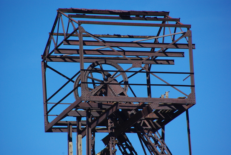
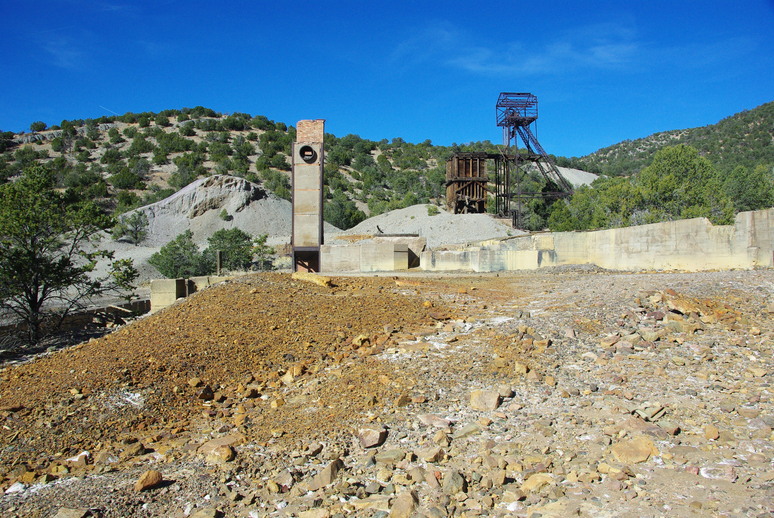
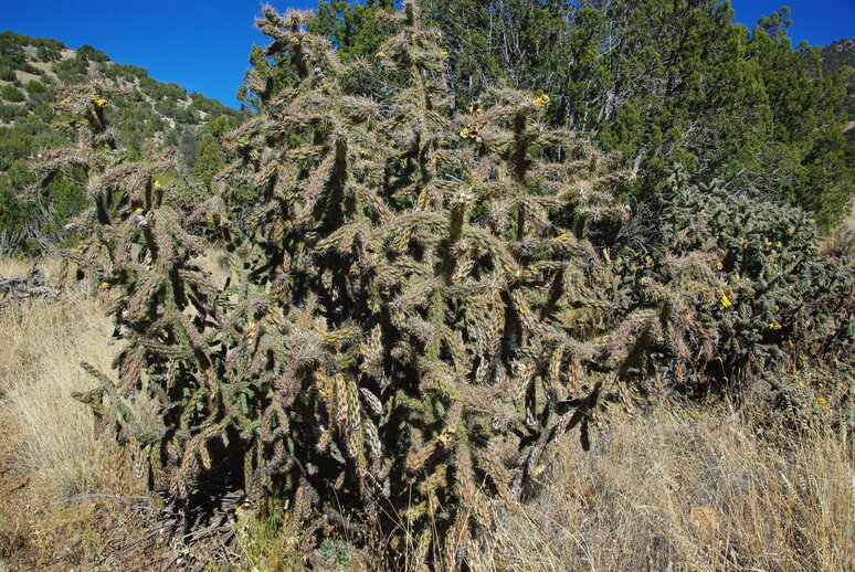
The shaft drops nearly 1,000 feet down into a maze of over 30 miles of tunnels, all now closed, silent as the grave. Catchy words from New Mexico True. Now, lots of cholla cactus grows in the area to obscure the former townsite.
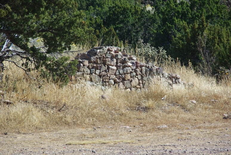
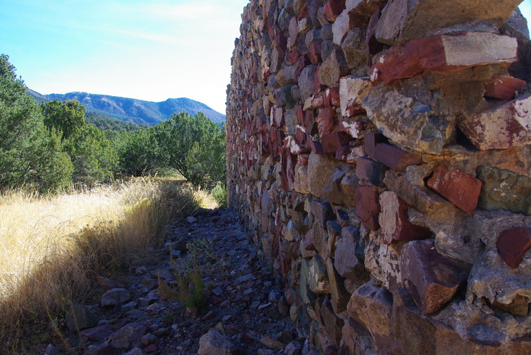
Very few indications are left of the thriving town. A few foundation remains can still be seen, as can some wonderfully colorful stone wall construction. We were not able to determine what the purpose of that particular building was used for. It’s a mystery!
Aside from the townsite itself, the views from the elevated altitude are also quite nice. This image is looking West from Kelly toward the San Augustine Plains in the distance.
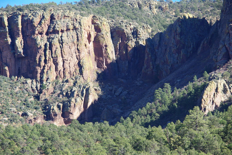
Water Canyon
Last stop of the day, Water Canyon! Another destination we drive by each time we go into civilization (Socorro) for supplies. Water canyon is a campground and picnic area located a bit west of Socorro on Highway 60 in the eastern side of the Magdalena mountain area. Not much to see except the scenery, which is very pretty.
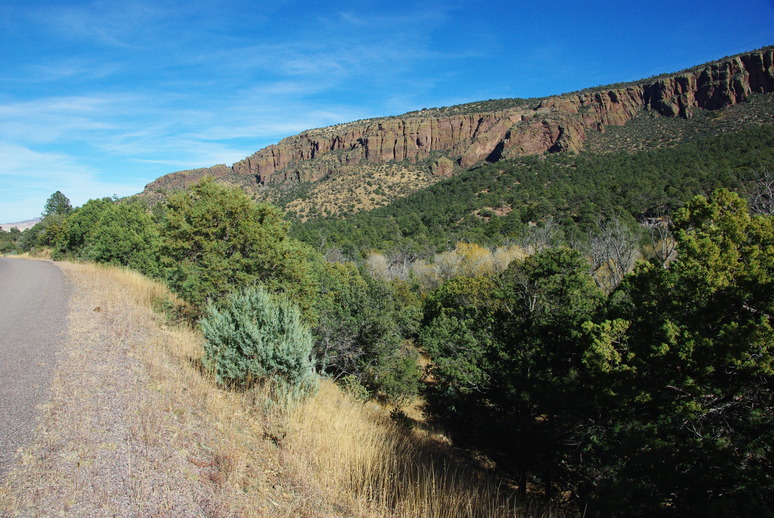
The best feature of Water Canyon is the rugged vistas available, such as this close up of the east side of the canyon.
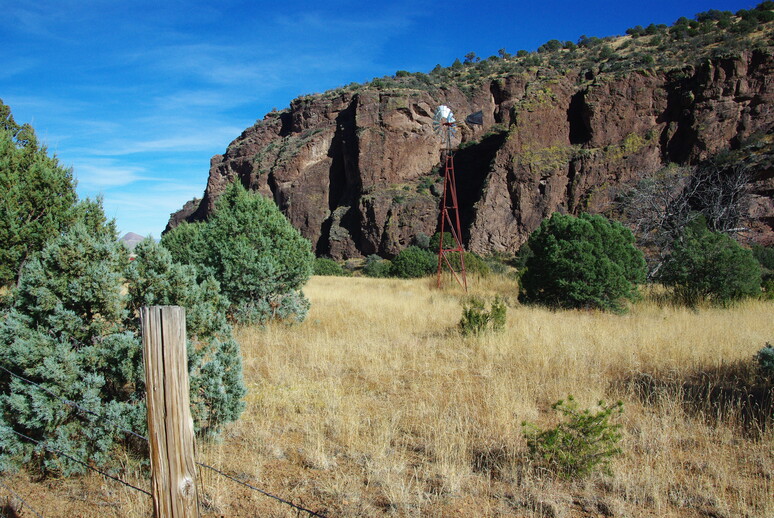
On the way out, we saw this wonderful operating windmill, hard at work lifting water from an unknown depth for the cattle’s drinking pleasure.
We had also contemplated including Bosque Del Apache Wildlife Refuge in our plans for the day, but by the time we left Water Canyon, it was late in the day. So that destination will have to wait for another opportunity. Also, it might be better to wait for the “crane festival” later in November. It’s a rather extensive area, so planning a whole day for that may be more appropriate.
We had an absolutely wonderful time touring these beautiful places, enjoying each others company, and generally having a “day off,” so to speak. Our marriage has been blessed, as only God can do. We ask His guidance in everything we do! So, that’s all for now. Hope you enjoyed this post and the beautiful scenery created by God’s hand. Be safe!